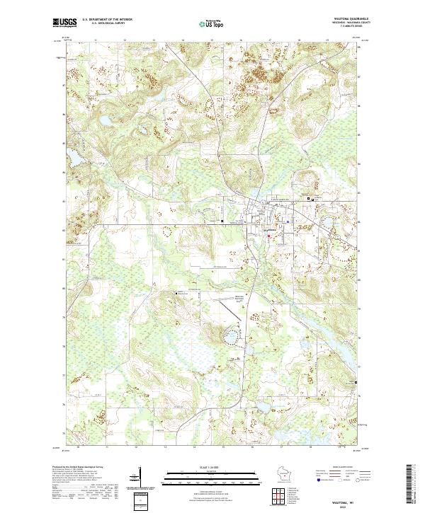
2022 Map of Wautoma
USGS Topo · Published 2022About this map
The city of Wautoma serves as the focal point of this Central Wisconsin landscape, where the White River and its various branches, including the W Br White River, create a complex network of wetlands and small lakes. The area's administrative and educational importance is marked by the Waushara County Courthouse downtown and the presence of Fox Valley Technical College. For genealogists and local historians, the sheet is exceptionally detailed with burial sites such as Wautoma Union Cem, Hope Lutheran Cem, and the more remote North Dakota Cem.
Find a feature on this map
81 named features on this map. Tap any name to fly to it.
Don’t see what you’re looking for? This feature index may not catch every label — zoom into the map to look around manually.
Map Details
Editions of this 2022 Wautoma Map
This is the sole edition of this map. No revisions or reprints were ever made.
Other maps of this area

1915 · Neshkoro
USGS Topo · 1:48,000

1918 · Neshkoro
USGS Topo · 1:62,500

1955 · Green Bay
USGS Topo · 1:250,000

1957 · Madison
USGS Topo · 1:250,000

1959 · Wautoma
USGS Topo · 1:48,000

1960 · Madison
USGS Topo · 1:250,000

1961 · Redgranite
USGS Topo · 1:62,500

1961 · Montello
USGS Topo · 1:62,500

1961 · Wild Rose
USGS Topo · 1:24,000

1961 · Spring Lake
USGS Topo · 1:24,000