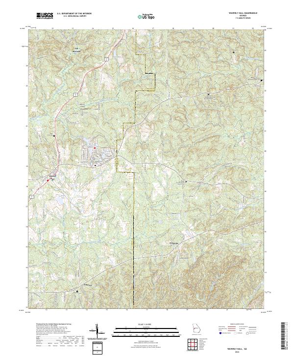
2024 Map of Waverly Hall
USGS Topo · Published 2024About this map
Waverly Hall serves as a primary settlement node in this section of western Georgia, where the rolling foothills of Oak Mountain meet a network of creek drainages. The landscape is defined by its rural heritage, anchored by numerous small community centers such as Baughville and Ridgeway. Genealogists will find a wealth of data in the many ecclesiastical sites scattered across the county line between Harris and Talbot, including the Bluff Spring Christian Methodist Episcopal Church Cem and Salem Primitive Baptist Church Cem. The topography is intricately carved by Ossahatchie Creek and Mulberry Creek, while local water bodies like Storey Lake and the Peeds Lakes cluster suggest a history of land management for agriculture or recreation. Transportation routes like Warm Springs Rd and Oak Mountain Rd follow the natural contours of the terrain, linking historic family-named cemeteries and remote homesteads.
Find a feature on this map
86 named features on this map. Tap any name to fly to it.
Don’t see what you’re looking for? This feature index may not catch every label — zoom into the map to look around manually.
Map Details
Editions of this 2024 Waverly Hall Map
This is the sole edition of this map. No revisions or reprints were ever made.
Other maps of this area

1907 · Talbotton
USGS Topo · 1:125,000

1934 · Warm Springs
USGS Topo · 1:62,500

1936 · Warm Springs
USGS Topo · 1:62,500

1949 · Midland
USGS Topo · 1:24,000

1949 · Upatoi
USGS Topo · 1:24,000

1950 · Talbotton
USGS Topo · 1:24,000

1950 · Geneva
USGS Topo · 1:24,000

1950 · Waverly Hall
USGS Topo · 1:24,000

1950 · Cataula
USGS Topo · 1:24,000

1950 · Talbotton
USGS Topo · 1:62,500