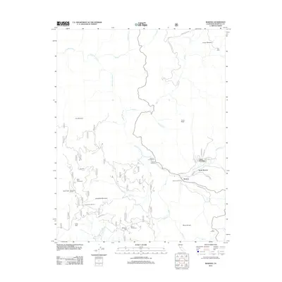
2012 Map of Wawona
USGS Topo · Published 2012About this map
The S Fork Merced River carves through this mountainous landscape, anchoring the historic communities of North Wawona, South Wawona, and Wawona. In the early 21st century, this area demonstrates a classic recreation-centered layout, where the Wawona Golf Course and various public camping facilities like Wawona Campground and Crowsfoot Campground serve as focal points for seasonal activity. High-altitude landmarks such as Signal Peak Lookout and Mount Savage overlook the river valley, providing a sense of the dramatic elevation shifts common in this part of the Sierra Nevada. To the south and west, the map details the rugged access points of the Chowchilla Mountains, featuring the Tenmile Grade and Battalion Pass. This survey illustrates the intricate network of forest roads and trails that connect remote outposts like Deer Camp to the main thoroughfares of Chilnualna Rd and Wawona Way.
Find a feature on this map
58 named features on this map. Tap any name to fly to it.
Don’t see what you’re looking for? This feature index may not catch every label — zoom into the map to look around manually.
Map Details
Editions of this 2012 Wawona Map
This is the sole edition of this map. No revisions or reprints were ever made.
Other maps of this area

1897 · Yosemite
USGS Topo · 1:125,000

1900 · Yosemite
USGS Topo · 1:125,000

1903 · Yosemite
USGS Topo · 1:125,000

1909 · Yosemite
USGS Topo · 1:125,000

1912 · Mariposa
USGS Topo · 1:125,000

1947 · El Portal
USGS Topo · 1:24,000

1947 · Mariposa
USGS Topo · 1:250,000

1947 · El Portal
USGS Topo · 1:62,500

1947 · Mariposa
USGS Topo · 1:62,500

1947 · Buckingham Mtn
USGS Topo · 1:24,000