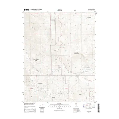
2015 Map of Wawona
USGS Topo · Published 2015About this map
Wawona serves as a central gateway between the Sierra National Forest and Yosemite National Park, positioned along the banks of the S Fork Merced River. This 2015 topography shows the split between North Wawona and South Wawona, illustrating how these settlements are integrated into the steep Sierra terrain. Notable mountain landmarks including Mt Savage, Crow Peak, and the Chowchilla Mountains frame the river valley, while the Tenmile Grade provides a glimpse into the historical routing through the high country. To the east, the water of Chilnualna Cr creates the dramatic Chilnualna Falls, a significant natural feature near the park boundary. The map effectively documents the transition from high-meadow landscapes like Empire Meadows to the rugged passes of the Sierra Nevada, including Battalion Pass.
Find a feature on this map
43 named features on this map. Tap any name to fly to it.
Don’t see what you’re looking for? This feature index may not catch every label — zoom into the map to look around manually.
Map Details
Editions of this 2015 Wawona Map
This is the sole edition of this map. No revisions or reprints were ever made.
Other maps of this area

1897 · Yosemite
USGS Topo · 1:125,000

1900 · Yosemite
USGS Topo · 1:125,000

1903 · Yosemite
USGS Topo · 1:125,000

1909 · Yosemite
USGS Topo · 1:125,000

1912 · Mariposa
USGS Topo · 1:125,000

1947 · El Portal
USGS Topo · 1:24,000

1947 · Mariposa
USGS Topo · 1:250,000

1947 · El Portal
USGS Topo · 1:62,500

1947 · Mariposa
USGS Topo · 1:62,500

1947 · Buckingham Mtn
USGS Topo · 1:24,000