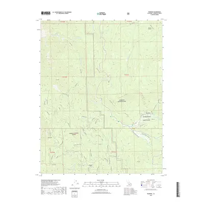
2018 Map of Wawona
USGS Topo · Published 2018About this map
Wawona serves as the central hub of this mountain landscape at the southern entrance of Yosemite National Park. Divided into North Wawona and South Wawona, the community is positioned along the S Fork Merced River, with the sprawling Wawona Meadow loop trail defining the local recreation. The map details a transition from the protected park lands to the Sierra National Forest further south. Historical remnants of the area's timber and exploration era are visible at the Greens Mill Site and the high point of Signal Peak. Deep in the backcountry, features like Empire Meadows and Battalion Pass suggest the early routes and seasonal camps used by explorers and forestry workers. A dense network of paths, including the Bishop Creek Trail and Chilnualna Falls Trail, crisscross the high elevations near Turner Ridge and Iron Mtn.
Find a feature on this map
64 named features on this map. Tap any name to fly to it.
Don’t see what you’re looking for? This feature index may not catch every label — zoom into the map to look around manually.
Map Details
Editions of this 2018 Wawona Map
This is the sole edition of this map. No revisions or reprints were ever made.
Other maps of this area

1897 · Yosemite
USGS Topo · 1:125,000

1900 · Yosemite
USGS Topo · 1:125,000

1903 · Yosemite
USGS Topo · 1:125,000

1909 · Yosemite
USGS Topo · 1:125,000

1912 · Mariposa
USGS Topo · 1:125,000

1947 · El Portal
USGS Topo · 1:24,000

1947 · Mariposa
USGS Topo · 1:250,000

1947 · El Portal
USGS Topo · 1:62,500

1947 · Mariposa
USGS Topo · 1:62,500

1947 · Buckingham Mtn
USGS Topo · 1:24,000