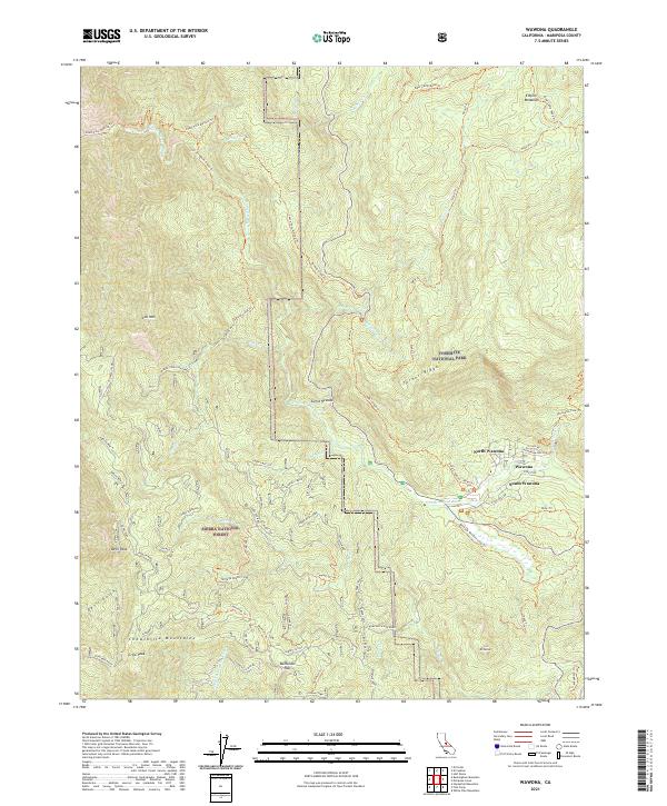
2021 Map of Wawona
USGS Topo · Published 2021About this map
Wawona serves as the central hub of this mountain landscape, flanked by its northern and southern extensions along the South Fork Merced River. This 2021 survey illustrates the complex boundary between Yosemite National Park and the Sierra National Forest, where the protected Merced Wild and Scenic River corridor carves through the Sierra Nevada. The map reveals a legacy of resource use and recreation, documenting the Greens Mill Site and an extensive network of historic pathways such as the South Fork Merced Trl and Alder Creek Trl. To the south, the Chowchilla Mountains rise toward Battalion Pass, while features like Empire Meadows and Turner Ridge highlight the high-altitude terrain. The mapping also captures specialized routes including the Ten Mile Grade, providing a detailed look at how transportation evolved across these steep ridges and river valleys.
Find a feature on this map
77 named features on this map. Tap any name to fly to it.
Don’t see what you’re looking for? This feature index may not catch every label — zoom into the map to look around manually.
Map Details
Editions of this 2021 Wawona Map
This is the sole edition of this map. No revisions or reprints were ever made.
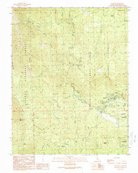
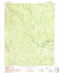
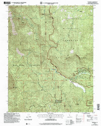
Historical Maps of Mariposa County Through Time
4 maps found