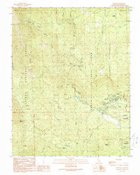
1990 Map of Wawona
USGS Topo · Published 1990About this map
Wawona serves as the focal point of this late 20th-century survey, situated along the South Fork Merced River at the southern entrance of Yosemite National Park. The landscape is defined by the transition between the Sierra National Forest and the park's wilderness boundaries, marked by high-elevation features like Iron Mountain and the Chowchilla Mountains. Human presence is concentrated around the river, where the Covered Bridge and Wawona Sch represent the local community infrastructure alongside recreational areas such as the Golf Course.
Find a feature on this map
37 named features on this map. Tap any name to fly to it.
Don’t see what you’re looking for? This feature index may not catch every label — zoom into the map to look around manually.
Map Details
Editions of this 1990 Wawona Map
This is the sole edition of this map. No revisions or reprints were ever made.
Other maps of this area

1897 · Yosemite
USGS Topo · 1:125,000

1900 · Yosemite
USGS Topo · 1:125,000

1903 · Yosemite
USGS Topo · 1:125,000

1909 · Yosemite
USGS Topo · 1:125,000

1912 · Mariposa
USGS Topo · 1:125,000

1947 · El Portal
USGS Topo · 1:24,000

1947 · Mariposa
USGS Topo · 1:250,000

1947 · El Portal
USGS Topo · 1:62,500

1947 · Mariposa
USGS Topo · 1:62,500

1947 · Buckingham Mtn
USGS Topo · 1:24,000