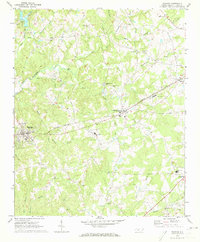
1970 Map of Waxhaw
USGS Topo · Published 1973About this map
Waxhaw and Mineral Springs anchor this 1970 landscape, where the Seaboard Coast Line cuts a straight diagonal through the terrain. The map captures a transitional rural economy, evidenced by several small landing strips and fields like Landing Strip and Landing Field scattered among the many creeks. Local education and faith are central to the settlement pattern, shown through landmarks like Western Union School and Parkwood School, alongside numerous country churches including Liberty Hill Church and Thompson Chapel.
Find a feature on this map
47 named features on this map. Tap any name to fly to it.
Don’t see what you’re looking for? This feature index may not catch every label — zoom into the map to look around manually.
Map Details
Editions of this 1970 Waxhaw Map
3 editions found
Other maps of this area

1905 · Charlotte
USGS Topo · 1:48,000

1907 · Charlotte
USGS Topo · 1:62,500

1941 · Charlotte
USGS Topo · 1:125,000

1941 · Spartanburg
USGS Topo · 1:250,000

1942 · Charlotte
USGS Topo · 1:125,000

1953 · Spartanburg
USGS Topo · 1:250,000

1953 · Charlotte
USGS Topo · 1:250,000

1954 · Charlotte
USGS Topo · 1:250,000

1960 · Charlotte
USGS Topo · 1:250,000

1960 · Spartanburg
USGS Topo · 1:250,000