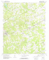
1970 Map of Waxhaw
USGS Topo · Published 1988About this map
Waxhaw and Mineral Springs serve as the primary hubs in this part of Union County, established along the corridor of the Seaboard Coast Line railroad. The landscape is defined by the complex drainage of Twelvemile Creek and its many tributaries, including East Fork Twelvemile Creek and Little Twelvemile Creek. This network of waterways dictated the early settlement patterns, with numerous small community centers and rural institutions scattered throughout the hills.
Find a feature on this map
40 named features on this map. Tap any name to fly to it.
Don’t see what you’re looking for? This feature index may not catch every label — zoom into the map to look around manually.
Map Details
Editions of this 1970 Waxhaw Map
3 editions found
Other maps of this area

1905 · Charlotte
USGS Topo · 1:48,000

1907 · Charlotte
USGS Topo · 1:62,500

1941 · Charlotte
USGS Topo · 1:125,000

1941 · Spartanburg
USGS Topo · 1:250,000

1942 · Charlotte
USGS Topo · 1:125,000

1953 · Spartanburg
USGS Topo · 1:250,000

1953 · Charlotte
USGS Topo · 1:250,000

1954 · Charlotte
USGS Topo · 1:250,000

1960 · Charlotte
USGS Topo · 1:250,000

1960 · Spartanburg
USGS Topo · 1:250,000