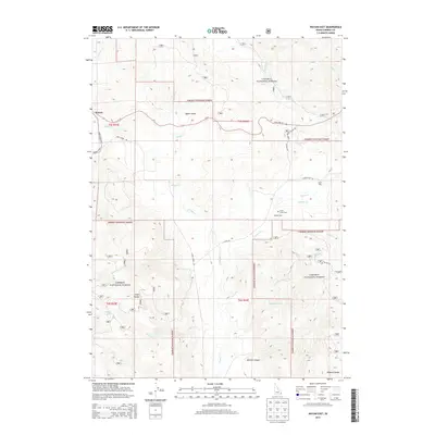
2013 Map of Wayan East
USGS Topo · Published 2013About this map
Caribou National Forest dominates this landscape in eastern Idaho, where the high-elevation valleys and mountain ranges define a region shaped by ranching and resource management. The small settlement of Wayan sits along State Hwy 34, serving as a gateway to the Upper Valley. This 2013 survey illustrates the area's agricultural heritage through labels for the Upper Dairy and Middle Dairy, and its early pioneer history is marked by the Lanes Grave Cem located near the banks of Lanes Cr.
Find a feature on this map
31 named features on this map. Tap any name to fly to it.
Don’t see what you’re looking for? This feature index may not catch every label — zoom into the map to look around manually.
Map Details
Editions of this 2013 Wayan East Map
This is the sole edition of this map. No revisions or reprints were ever made.
Other maps of this area

1915 · Freedom
USGS Topo · 1:62,500

1915 · Lanes Creek
USGS Topo · 1:62,500

1932 · Irwin
USGS Topo · 1:96,000

1935 · Irwin
USGS Topo · 1:125,000

1949 · Lower Valley
USGS Topo · 1:24,000

1951 · Lower Valley
USGS Topo · 1:24,000
1951 · Upper Valley
USGS Topo · 1:24,000

1955 · Driggs
USGS Topo · 1:250,000

1955 · Preston
USGS Topo · 1:250,000

1958 · Driggs
USGS Topo · 1:250,000