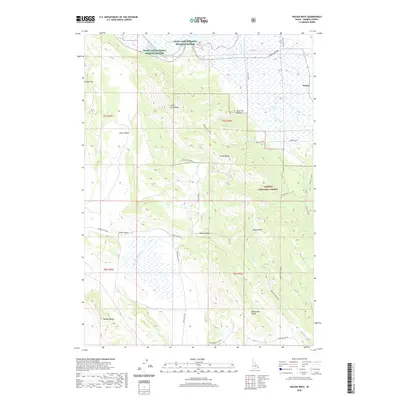
2020 Map of Wayan West
USGS Topo · Published 2020About this map
Grays Lake National Wildlife Refuge dominates the northern landscape of this Caribou County region, where the marshy waters of Grays Lake meet the foothills of the Grays Range. The small settlement of Wayan sits at a crossroads near the eastern edge of the wetlands, serving as a focal point for the surrounding ranching and timber country. The terrain is defined by a series of parallel ridges and valleys, including Little Gray Ridge and the Wooley Range, which flank the agricultural corridor of Clark Valley and Enoch Valley.
Find a feature on this map
38 named features on this map. Tap any name to fly to it.
Don’t see what you’re looking for? This feature index may not catch every label — zoom into the map to look around manually.
Map Details
Editions of this 2020 Wayan West Map
This is the sole edition of this map. No revisions or reprints were ever made.
Other maps of this area

1914 · Henry
USGS Topo · 1:48,000

1915 · Lanes Creek
USGS Topo · 1:62,500

1916 · Henry
USGS Topo · 1:62,500

1917 · Cranes Flat
USGS Topo · 1:62,500

1932 · Irwin
USGS Topo · 1:96,000

1935 · Irwin
USGS Topo · 1:125,000

1949 · Lower Valley
USGS Topo · 1:24,000

1951 · Lower Valley
USGS Topo · 1:24,000
1951 · Upper Valley
USGS Topo · 1:24,000

1955 · Driggs
USGS Topo · 1:250,000