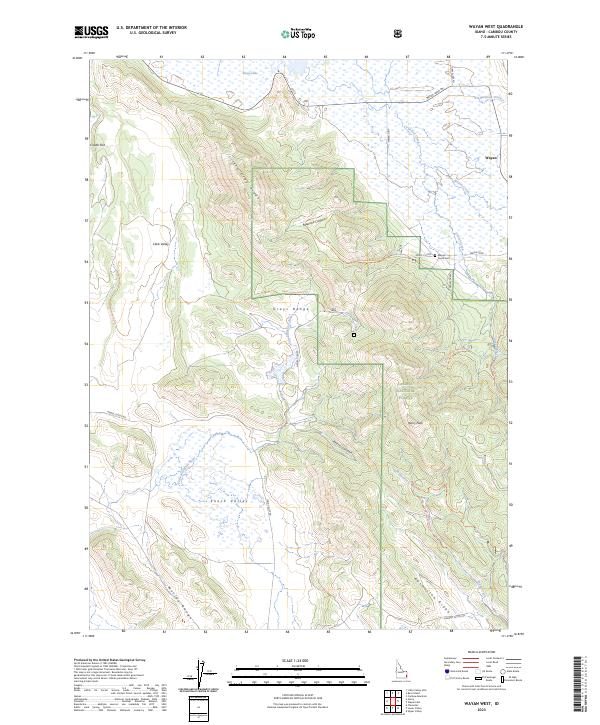
2023 Map of Wayan West
USGS Topo · Published 2023About this map
The settlement of Wayan sits at the edge of a high-altitude landscape where the Grays Lake National Wildlife Refuge meets the timbered slopes of the Caribou National Forest. This modern survey reveals a quiet agricultural and wilderness area defined by high valleys like Enoch Valley and Clark Valley, separated by the prominent Grays Range. Genealogical interest centers on Wayan South Cem, located along the Wayan Loop near the confluence of Gravel Creek and Wayan Creek. The mapping of the Little Blackfoot River and its associated wetlands near Grays Lake illustrates a complex hydrologic system managed for conservation. Industrial and recreational access is traced through a network of forest roads and trails, including Henry Cutoff and the Gravel Creek North Trl, which navigate the steep terrain around Henry Peak and Rasmussen Ridge.
Find a feature on this map
37 named features on this map. Tap any name to fly to it.
Don’t see what you’re looking for? This feature index may not catch every label — zoom into the map to look around manually.
Map Details
Editions of this 2023 Wayan West Map
This is the sole edition of this map. No revisions or reprints were ever made.
Other maps of this area

1914 · Henry
USGS Topo · 1:48,000

1915 · Lanes Creek
USGS Topo · 1:62,500

1916 · Henry
USGS Topo · 1:62,500

1917 · Cranes Flat
USGS Topo · 1:62,500

1932 · Irwin
USGS Topo · 1:96,000

1935 · Irwin
USGS Topo · 1:125,000

1949 · Lower Valley
USGS Topo · 1:24,000

1951 · Lower Valley
USGS Topo · 1:24,000
1951 · Upper Valley
USGS Topo · 1:24,000

1955 · Driggs
USGS Topo · 1:250,000