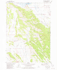
1980 Map of Wayan West
USGS Topo · Published 1980About this map
The Emigrant Trail (Lander Cutoff) traces a historic route across this high-elevation landscape, marking a legacy of westward migration that persists alongside modern industrial activity. Situated within the Caribou National Forest, the area transitions from the marshy edges of Grays Lake and its Gaging Sta in the north to the industrial footprint of the Henry Strip Mine in the south. The settlement of Wayan serves as a small hub near the junction of several drainage systems, including Harrison Creek and Gravel Creek.
Find a feature on this map
26 named features on this map. Tap any name to fly to it.
Don’t see what you’re looking for? This feature index may not catch every label — zoom into the map to look around manually.
Map Details
Editions of this 1980 Wayan West Map
This is the sole edition of this map. No revisions or reprints were ever made.
Other maps of this area

1914 · Henry
USGS Topo · 1:48,000

1915 · Lanes Creek
USGS Topo · 1:62,500

1916 · Henry
USGS Topo · 1:62,500

1917 · Cranes Flat
USGS Topo · 1:62,500

1932 · Irwin
USGS Topo · 1:96,000

1935 · Irwin
USGS Topo · 1:125,000

1949 · Lower Valley
USGS Topo · 1:24,000

1951 · Lower Valley
USGS Topo · 1:24,000
1951 · Upper Valley
USGS Topo · 1:24,000

1955 · Driggs
USGS Topo · 1:250,000