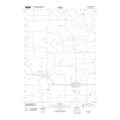
2010 Map of Wayland
USGS Topo · Published 2010About this map
Wayland serves as the primary hub of this rural Iowa landscape, situated at the intersection of Wayland Rd and 111th St. The surrounding countryside is defined by the winding course of the Skunk River and its numerous tributaries, including Crooked Creek and Williams Creek. This area is particularly notable for its dense concentration of burial sites, reflecting generations of family settlement across the Henry and Washington county line.
Find a feature on this map
59 named features on this map. Tap any name to fly to it.
Don’t see what you’re looking for? This feature index may not catch every label — zoom into the map to look around manually.
Map Details
Editions of this 2010 Wayland Map
This is the sole edition of this map. No revisions or reprints were ever made.
Other maps of this area

1958 · Davenport
USGS Topo · 1:250,000

1961 · Davenport
USGS Topo · 1:250,000

1962 · Davenport
USGS Topo · 1:250,000

1969 · Washington
USGS Topo · 1:24,000

1970 · Ainsworth
USGS Topo · 1:24,000

1973 · West Chester
USGS Topo · 1:24,000

1980 · Brighton
USGS Topo · 1:24,000

1980 · Trenton
USGS Topo · 1:24,000

1980 · Wayland
USGS Topo · 1:24,000
1980 · Salina
USGS Topo · 1:24,000