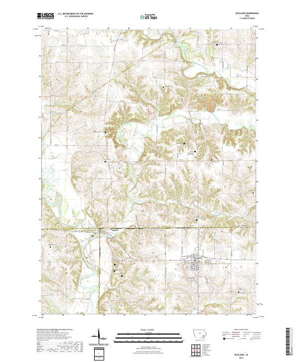
2022 Map of Wayland
USGS Topo · Published 2022About this map
Wayland and the surrounding farmland of Henry, Washington, and Jefferson counties are defined by a landscape of rolling stream valleys and a grid of secondary roads. The Skunk River cuts across the southwest, while the intricate drainages of Crooked Creek and Williams Creek carve the central and northern reaches of the quadrangle. For genealogists, the map is remarkably dense with family-named landmarks and local burial sites, such as the Bethel Mennonite Church and numerous rural cemeteries including Sommers Cem, Schrock Cem, and Elcher Cem.
Find a feature on this map
72 named features on this map. Tap any name to fly to it.
Don’t see what you’re looking for? This feature index may not catch every label — zoom into the map to look around manually.
Map Details
Editions of this 2022 Wayland Map
This is the sole edition of this map. No revisions or reprints were ever made.
Other maps of this area

1958 · Davenport
USGS Topo · 1:250,000

1961 · Davenport
USGS Topo · 1:250,000

1962 · Davenport
USGS Topo · 1:250,000

1969 · Washington
USGS Topo · 1:24,000

1970 · Ainsworth
USGS Topo · 1:24,000

1973 · West Chester
USGS Topo · 1:24,000

1980 · Brighton
USGS Topo · 1:24,000

1980 · Trenton
USGS Topo · 1:24,000

1980 · Wayland
USGS Topo · 1:24,000
1980 · Salina
USGS Topo · 1:24,000