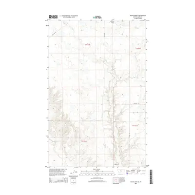
2014 Map of Wayne Creek SE
USGS Topo · Published 2014About this map
Savoy Creek winds through this northern Montana landscape, anchoring a network of intermittent waterways including Lone Tree Coulee and Black Creek. The terrain is defined by the high plains of Blaine County, where early 21st-century topography shows a spare but intentional grid of movement. Local travel relies on established paths like Wayne Creek Rd and Old Savoy Rd, while the name of Homestead Trl provides a direct link to the region's agricultural settlement history. The presence of Mud Lake in the northwest quadrant indicates the seasonal water patterns typical of this northern prairie environment. This quadrangle provides a detailed look at the rural intersection of Townships 32 and 33 North, preserving the exact layout of drainage and access roads during this period.
Find a feature on this map
11 named features on this map. Tap any name to fly to it.
Don’t see what you’re looking for? This feature index may not catch every label — zoom into the map to look around manually.
Map Details
Editions of this 2014 Wayne Creek SE Map
This is the sole edition of this map. No revisions or reprints were ever made.
Other maps of this area

1903 · Wayne Creek
USGS Topo · 1:62,500

1905 · Wayne Creek
USGS Topo · 1:62,500

1913 · Cherry Ridge
USGS Topo · 1:125,000

1920 · Avery
USGS Topo · 1:125,000

1953 · Havre
USGS Topo · 1:250,000

1957 · Havre
USGS Topo · 1:250,000

1958 · Havre
USGS Topo · 1:250,000

1964 · Threemile Reservoir
USGS Topo · 1:24,000

1964 · Wayne Creek SE
USGS Topo · 1:24,000

1964 · Coburg
USGS Topo · 1:24,000