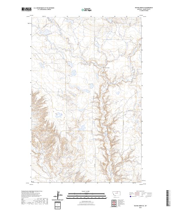
2024 Map of Wayne Creek SE
USGS Topo · Published 2024About this map
Savoy Creek and Black Creek carve a network of drainages through the prairie of Blaine County, defining the drainage patterns of this high plains landscape. This part of Montana remains characterized by its vast open spaces and rural infrastructure, where routes like Wayne Creek Rd and N Savoy Rd provide the primary access to isolated homesteads and grazing lands. The presence of Lone Tree Coulee highlights the topographical relief found in the coulees and draws that break up the level horizon. Mud Lake serves as a rare landmark in the western portion of the quadrangle, which is otherwise defined by the geometric precision of the Public Land Survey System, including t33n r24e and t32n r25e. The network of trails, such as Homestead Trl, underscores the area's continued reliance on historic ranching corridors.
Find a feature on this map
13 named features on this map. Tap any name to fly to it.
Don’t see what you’re looking for? This feature index may not catch every label — zoom into the map to look around manually.
Map Details
Editions of this 2024 Wayne Creek SE Map
This is the sole edition of this map. No revisions or reprints were ever made.
Other maps of this area

1903 · Wayne Creek
USGS Topo · 1:62,500

1905 · Wayne Creek
USGS Topo · 1:62,500

1913 · Cherry Ridge
USGS Topo · 1:125,000

1920 · Avery
USGS Topo · 1:125,000

1953 · Havre
USGS Topo · 1:250,000

1957 · Havre
USGS Topo · 1:250,000

1958 · Havre
USGS Topo · 1:250,000

1964 · Threemile Reservoir
USGS Topo · 1:24,000

1964 · Wayne Creek SE
USGS Topo · 1:24,000

1964 · Coburg
USGS Topo · 1:24,000