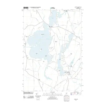
2011 Map of Wayne
USGS Topo · Published 2011About this map
Pocasset Lake and Wilson Pond anchor this landscape in south-central Maine, where the villages of Wayne and North Monmouth sit amidst a network of interconnected waterways. The hydrologic connectivity is a defining feature of the area, evidenced by a series of water-control structures including the Wayne Village Dam, Wilson Pond Dam, and Lovejoy Pond Dam. The intricate shoreline of Pocasset Lake is dotted with landmarks like Androscoggin Island, Norris Island, and Blodgett Island, while the surrounding hills rise to local heights at Mount Pisgah and Morrison Heights. Genealogists will find interest in several historic burial grounds, such as Wing Cemetery near the north shore and Glenside Cemetery to the east. The map captures a mix of rural settlement and recreational geography, from the Riverbend Campground along the Dead River to the residential clusters at Curtis Corner and North Wayne.
Find a feature on this map
115 named features on this map. Tap any name to fly to it.
Don’t see what you’re looking for? This feature index may not catch every label — zoom into the map to look around manually.
Map Details
Editions of this 2011 Wayne Map
This is the sole edition of this map. No revisions or reprints were ever made.
Other maps of this area

1892 · Gardiner
USGS Topo · 1:62,500

1892 · Augusta
USGS Topo · 1:62,500

1908 · Lewiston
USGS Topo · 1:62,500

1910 · Livermore
USGS Topo · 1:62,500

1912 · Livermore
USGS Topo · 1:62,500

1941 · Livermore
USGS Topo · 1:62,500

1941 · Augusta
USGS Topo · 1:62,500

1942 · Lewiston
USGS Topo · 1:62,500

1943 · Augusta
USGS Topo · 1:62,500

1943 · Gardiner
USGS Topo · 1:62,500