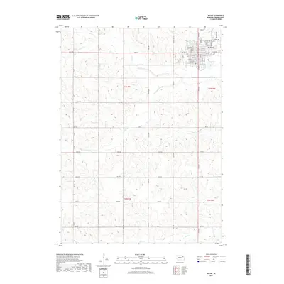
2017 Map of Wayne
USGS Topo · Published 2017About this map
Wayne serves as the regional hub of northeastern Nebraska in this 2017 survey, dominated by the campus of Wayne State College and the organized grid of the city's residential and commercial streets. The surrounding landscape is defined by the rolling drainage basins of S Logan Cr, Deer Cr, and Plum Cr, which carve through the agricultural plateau. Local history is anchored at the Greenwood Cem and the Fairgrounds Ave area, while the rural township sections reveal a rigid section-line road network including 856th Rd and Grainland Rd. This map captures the modern layout of the college town at the intersection of traditional plains farming and higher education development.
Find a feature on this map
44 named features on this map. Tap any name to fly to it.
Don’t see what you’re looking for? This feature index may not catch every label — zoom into the map to look around manually.
Map Details
Editions of this 2017 Wayne Map
This is the sole edition of this map. No revisions or reprints were ever made.
Other maps of this area

1955 · Sioux City
USGS Topo · 1:250,000

1958 · Sioux City
USGS Topo · 1:250,000

1959 · Sioux City
USGS Topo · 1:250,000

1963 · Pilger
USGS Topo · 1:24,000

1963 · Wayne SW
USGS Topo · 1:24,000

1963 · Altona
USGS Topo · 1:24,000

1963 · Winside
USGS Topo · 1:24,000

1963 · Wayne
USGS Topo · 1:24,000

1966 · Altona NW
USGS Topo · 1:24,000

1967 · Wakefield SW
USGS Topo · 1:24,000