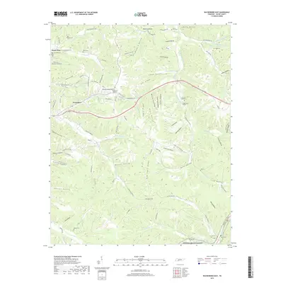
2019 Map of Waynesboro East
USGS Topo · Published 2019About this map
Waynesboro serves as the focal point for this survey of eastern Wayne County, where the Highland Rim's dissected landscape is defined by long ridges and deep hollows. The eastern portion of the town gives way to a network of creeks and timbered heights, including Negro Ridge and Dick Cabin Ridge. Family history is preserved in numerous upland burial sites such as Copeland Cem and Keeton Cem, while the Wayne County Memorial Gardens marks more recent development.
Find a feature on this map
113 named features on this map. Tap any name to fly to it.
Don’t see what you’re looking for? This feature index may not catch every label — zoom into the map to look around manually.
Map Details
Editions of this 2019 Waynesboro East Map
This is the sole edition of this map. No revisions or reprints were ever made.
Other maps of this area

1905 · Waynesboro
USGS Topo · 1:125,000

1936 · Riverside
USGS Topo · 1:24,000

1936 · Westpoint
USGS Topo · 1:24,000

1936 · Collinwood
USGS Topo · 1:24,000

1936 · Leatherwood
USGS Topo · 1:24,000

1936 · Negro Hollow
USGS Topo · 1:24,000

1936 · Three Churches
USGS Topo · 1:24,000

1936 · Waynesboro
USGS Topo · 1:24,000

1936 · Topsy
USGS Topo · 1:24,000

1936 · Ovilla
USGS Topo · 1:24,000