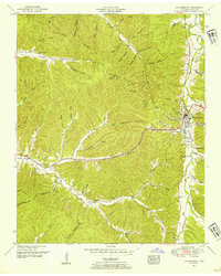
1951 Map of Waynesboro
USGS Topo · Published 1954About this map
Waynesboro serves as the central hub of this Wayne County landscape, situated where Green River and Hurricane Creek converge. The topography is defined by the prominent Copeland Ridge, which separates numerous drainage basins and hollows. For genealogists and local historians, the 1951 field examination captured a detailed network of family cemeteries and rural landmarks, including Warren Cem, Kelley Cem, and an Indian grave located near Warren Hollow.
Find a feature on this map
66 named features on this map. Tap any name to fly to it.
Don’t see what you’re looking for? This feature index may not catch every label — zoom into the map to look around manually.
Map Details
Editions of this 1951 Waynesboro Map
2 editions found
Other maps of this area

1905 · Waynesboro
USGS Topo · 1:125,000

1936 · Collinwood
USGS Topo · 1:24,000

1936 · Eagle Creek
USGS Topo · 1:24,000

1936 · Leatherwood
USGS Topo · 1:24,000

1936 · Negro Hollow
USGS Topo · 1:24,000

1936 · Clifton
USGS Topo · 1:24,000

1936 · Three Churches
USGS Topo · 1:24,000

1936 · Waynesboro
USGS Topo · 1:24,000

1936 · Martins Mills
USGS Topo · 1:24,000

1936 · Topsy
USGS Topo · 1:24,000