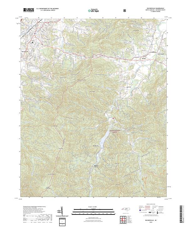
2022 Map of Waynesville
USGS Topo · Published 2022About this map
Lake Logan sits at the heart of this Haywood County landscape, where the West Fork Pigeon River flows north toward the settlements of Bethel and Hazelwood. This modern survey highlights the complex topography of the Great Balsam Mountains, featuring prominent landmarks like Lickstone Bald and Cold Spring Knob. The distribution of older community names such as Sunburst, Retreat, and Woodrow reveals the legacy of mountain settlement along the narrow valley floors. Near the northern map edge, the Haywood County Justice Center and Green Hill Cem mark the outskirts of the county seat's expansion. Higher elevations are dominated by the Pisgah National Forest, where trails like the Art Loeb Trail traverse ridges such as Three Tree Ridge and Snaggy Ridge. This map illustrates the intersection of public lands, industrial history at Burnett Siding, and contemporary rural development.
Find a feature on this map
90 named features on this map. Tap any name to fly to it.
Don’t see what you’re looking for? This feature index may not catch every label — zoom into the map to look around manually.
Map Details
Editions of this 2022 Waynesville Map
This is the sole edition of this map. No revisions or reprints were ever made.
Other maps of this area

1891 · Cowee
USGS Topo · 1:125,000

1893 · Mt Guyot
USGS Topo · 1:125,000

1894 · Asheville
USGS Topo · 1:125,000

1897 · Cowee
USGS Topo · 1:125,000

1901 · Asheville
USGS Topo · 1:125,000

1905 · Pisgah
USGS Topo · 1:125,000

1906 · Pisgah
USGS Topo · 1:125,000

1907 · Cowee
USGS Topo · 1:125,000

1912 · Mt Guyot
USGS Topo · 1:125,000

1935 · Cruso
USGS Topo · 1:24,000