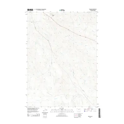
2014 Map of Wayside
USGS Topo · Published 2014About this map
Wayside stands as the primary namesake settlement in this northern Nebraska landscape, situated near the prominent landform of Wayside Butte. The area is defined by an intricate network of drainage systems, including Bohemian Cr, Rush Cr, and Lone Tree Cr, which carve through the terrain of Dawes County. The spatial layout of the region is anchored by Us-385, which cuts diagonally across the northern portion, while local routes like Stewart Rd and Airport Rd provide access to the interior grazing lands. This 2014 survey illustrates the persistence of rural cattle country, where the geography is organized around named waterways such as Bull Cr and Peterson Cr rather than dense urban development, preserving a pattern of land use that has characterized the High Plains for generations.
Find a feature on this map
13 named features on this map. Tap any name to fly to it.
Don’t see what you’re looking for? This feature index may not catch every label — zoom into the map to look around manually.
Map Details
Editions of this 2014 Wayside Map
This is the sole edition of this map. No revisions or reprints were ever made.
Other maps of this area

1896 · Oelrichs
USGS Topo · 1:125,000

1900 · Oelrichs
USGS Topo · 1:125,000

1955 · Hot Springs
USGS Topo · 1:250,000

1955 · Alliance
USGS Topo · 1:250,000

1957 · Alliance
USGS Topo · 1:250,000

1958 · Alliance
USGS Topo · 1:250,000
1970 · Bohemian Creek
USGS Topo · 1:24,000

1980 · Lone Tree Ranch
USGS Topo · 1:24,000

1980 · Wayside
USGS Topo · 1:24,000
1980 · Trunk Butte
USGS Topo · 1:24,000