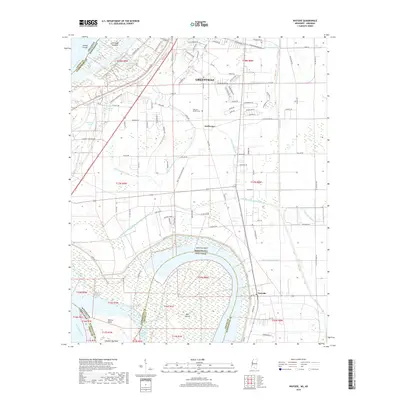
2018 Map of Wayside
USGS Topo · Published 2018About this map
Greenville sits at the northern edge of this Delta landscape, where the shifting hydrology of the Mississippi River defines the border between Washington County, Mississippi, and Chicot County, Arkansas. The map illustrates a highly engineered agricultural environment, crisscrossed by an extensive drainage network including Ditch Number Five, Ditch Number Eight, and the Main Canal. These channels work in tandem with the massive Levee Rd system to manage the fertile floodplains surrounding settlements like Swiftwater and Wayside.
Find a feature on this map
113 named features on this map. Tap any name to fly to it.
Don’t see what you’re looking for? This feature index may not catch every label — zoom into the map to look around manually.
Map Details
Editions of this 2018 Wayside Map
This is the sole edition of this map. No revisions or reprints were ever made.
Other maps of this area

1939 · Readland
USGS Topo · 1:62,500

1939 · Refuge
USGS Topo · 1:62,500

1939 · Tralake
USGS Topo · 1:62,500

1939 · Swan Lake
USGS Topo · 1:62,500

1953 · Greenwood
USGS Topo · 1:250,000

1956 · Greenwood
USGS Topo · 1:250,000

1967 · Arcola
USGS Topo · 1:24,000

1967 · Leland
USGS Topo · 1:24,000
1967 · Swan Lake NW
USGS Topo · 1:24,000
1969 · Swan Lake
USGS Topo · 1:62,500