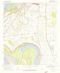
1970 Map of Wayside
USGS Topo · Published 1972About this map
Alexander Island dominates the bend of the Mississippi River along the Chicot and Washington County line, showcasing the complex riparian landscape of the Delta during the late 1960s. The area south of Greenville reveals a dense network of spiritual and social centers, including Mt Calvary Ch, Walnut Grove Ch, and the distinctive The Old Evening Star Ch.
Find a feature on this map
36 named features on this map. Tap any name to fly to it.
Don’t see what you’re looking for? This feature index may not catch every label — zoom into the map to look around manually.
Map Details
Editions of this 1970 Wayside Map
This is the sole edition of this map. No revisions or reprints were ever made.
Other maps of this area

1939 · Readland
USGS Topo · 1:62,500

1939 · Refuge
USGS Topo · 1:62,500

1939 · Tralake
USGS Topo · 1:62,500

1939 · Swan Lake
USGS Topo · 1:62,500

1953 · Greenwood
USGS Topo · 1:250,000

1956 · Greenwood
USGS Topo · 1:250,000

1967 · Arcola
USGS Topo · 1:24,000

1967 · Leland
USGS Topo · 1:24,000
1967 · Swan Lake NW
USGS Topo · 1:24,000
1969 · Swan Lake
USGS Topo · 1:62,500