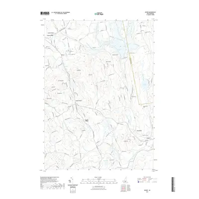
2021 Map of Weare
USGS Topo · Published 2021About this map
The Piscataquog River and its multiple branches define the rugged topography of this Hillsborough County landscape. North of the massive Everett Dam, the sprawling waters of Everett Lake dominate the northeastern terrain, bordered by the local landmarks Raymond Cliff and Barnard Hill. The area is characterized by several distinct historic centers, including North Weare, South Weare, and the descriptively named Tavern Village and Chase Village. Genealogists will find a high density of burial grounds throughout the township, such as the Quaker Cem and East Weare Cem. The landscape is heavily marked by granite heights like Mt William and Mt Dearborn, while the southern reaches follow the South Branch Piscataquog River toward Parker and the Kuncanowet Hills.
Find a feature on this map
141 named features on this map. Tap any name to fly to it.
Don’t see what you’re looking for? This feature index may not catch every label — zoom into the map to look around manually.
Map Details
Editions of this 2021 Weare Map
This is the sole edition of this map. No revisions or reprints were ever made.
Other maps of this area

1900 · Peterboro
USGS Topo · 1:62,500

1906 · Milford
USGS Topo · 1:62,500

1926 · Hillsboro
USGS Topo · 1:62,500

1927 · Concord
USGS Topo · 1:62,500

1929 · Hillsboro
USGS Topo · 1:62,500

1943 · Fitchburg
USGS Topo · 1:125,000

1948 · Boston
USGS Topo · 1:250,000

1949 · Portland
USGS Topo · 1:250,000

1949 · Concord
USGS Topo · 1:62,500
1953 · Peterborough
USGS Topo · 1:62,500