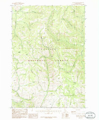
1986 Map of Weasel Gulch
USGS Topo · Published 1986About this map
Payette National Forest dominates this mid-1980s topography, a landscape defined by an intricate network of drainages and seasonal springs. The eastern edge of the map follows the course of the Weiser River and its West Fork, while the southern portion is carved by the North Fork Hornet Creek and Left Fork Hornet Creek. This area of Idaho is characterized by numerous gulches and canyons named for local flora, fauna, and early explorers, including Weasel Gulch, Bull Gulch, and Robison Gulch. Evidence of land use is visible at the Gravel Pit near the northern boundary. Genealogists and local historians can trace named natural landmarks like Harrington Spring and Dean Spring, which likely served as critical water sources for livestock and early travelers navigating these mountain passes before more modernized infrastructure was established.
Find a feature on this map
28 named features on this map. Tap any name to fly to it.
Don’t see what you’re looking for? This feature index may not catch every label — zoom into the map to look around manually.
Map Details
Editions of this 1986 Weasel Gulch Map
This is the sole edition of this map. No revisions or reprints were ever made.
Other maps of this area

1911 · Meadows
USGS Topo · 1:125,000

1920 · Seven Devils Mining District
USGS Topo · 1:48,000

1938 · Riggins
USGS Topo · 1:96,000

1945 · Riggins
USGS Topo · 1:125,000

1954 · New Meadows
USGS Topo · 1:62,500

1955 · Baker
USGS Topo · 1:250,000

1955 · Grangeville
USGS Topo · 1:250,000

1957 · Cuprum
USGS Topo · 1:62,500

1957 · Hornet
USGS Topo · 1:62,500

1959 · Baker
USGS Topo · 1:250,000