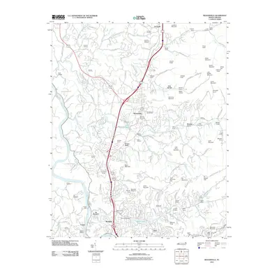
2010 Map of Weaverville
USGS Topo · Published 2010About this map
Weaverville and the northern outskirts of Asheville occupy the central corridor of this survey, where the landscape is defined by the transition from the French Broad River valley to the heights of the Elk Mountains. The area reflects a mix of long-standing family legacies and modern recreational developments, anchored by the Vance Homestead and the Asheville-Weaverville Speedway. Small settlements like Woodfin, Stocksville, and Pleasant Grove are interspersed with numerous family-named burial grounds, including Sheppard and Coles, which serve as vital markers for local genealogy. To the south, the development of Beaver Lake and the Beaver Lake Golf Course illustrates the suburban expansion toward Grace. Significant topographic features like Gouch Peak and Reynolds Mountain overlook the winding Elk Mountain Scenic Hwy, providing a detailed look at the residential and natural geography of Buncombe County.
Find a feature on this map
156 named features on this map. Tap any name to fly to it.
Don’t see what you’re looking for? This feature index may not catch every label — zoom into the map to look around manually.
Map Details
Editions of this 2010 Weaverville Map
This is the sole edition of this map. No revisions or reprints were ever made.
Other maps of this area

1894 · Asheville
USGS Topo · 1:125,000

1900 · Mount Mitchell
USGS Topo · 1:125,000

1901 · Asheville
USGS Topo · 1:125,000

1902 · Mount Mitchell
USGS Topo · 1:125,000

1935 · Barnardsville
USGS Topo · 1:24,000

1935 · Craggy Pinnacle
USGS Topo · 1:24,000

1936 · Marshall
USGS Topo · 1:24,000

1936 · Enka
USGS Topo · 1:24,000

1936 · Weaverville
USGS Topo · 1:24,000

1936 · Mars Hill
USGS Topo · 1:24,000