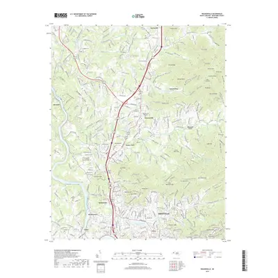
2019 Map of Weaverville
USGS Topo · Published 2019About this map
The French Broad River carves a deep valley along the western edge of this Buncombe County landscape, where the Blue Ridge foothills rise toward Hamburg Mtn and Baird Mtn. Centered on the town of Weaverville, the map reveals a community defined by its topography, with residential growth concentrated in valleys like Brittain Cove and Herron Cove while higher elevations remain preserved as open space. Genealogy researchers will find numerous small family and community burial grounds, including Coles Cem in the northeast and Old Macedonia Cem near Woodfin. Notable infrastructure includes the Elk Mountain Scenic Hwy winding along the southern ridges toward Asheville, and the Weaverville Reservoir tucked into the eastern heights. The map also documents modern commemorative sites like the Ashelawn Gardens of Memory Memorial Garden, contrasting with traditional rural anchors like Clarks Chapel Ch and Flat Creek Ch.
Find a feature on this map
90 named features on this map. Tap any name to fly to it.
Don’t see what you’re looking for? This feature index may not catch every label — zoom into the map to look around manually.
Map Details
Editions of this 2019 Weaverville Map
This is the sole edition of this map. No revisions or reprints were ever made.
Other maps of this area

1894 · Asheville
USGS Topo · 1:125,000

1900 · Mount Mitchell
USGS Topo · 1:125,000

1901 · Asheville
USGS Topo · 1:125,000

1902 · Mount Mitchell
USGS Topo · 1:125,000

1935 · Barnardsville
USGS Topo · 1:24,000

1935 · Craggy Pinnacle
USGS Topo · 1:24,000

1936 · Marshall
USGS Topo · 1:24,000

1936 · Enka
USGS Topo · 1:24,000

1936 · Weaverville
USGS Topo · 1:24,000

1936 · Mars Hill
USGS Topo · 1:24,000