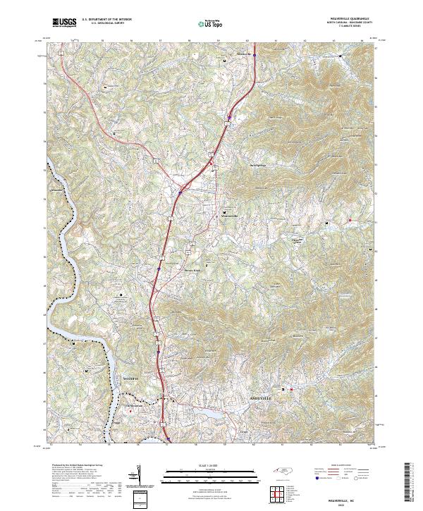
2022 Map of Weaverville
USGS Topo · Published 2022About this map
Weaverville and its surrounding mountain communities sit at the heart of this Buncombe County landscape, where the French Broad River carves through the western valley. This modern survey illustrates a high-elevation environment defined by ridges and gaps, including Hemphill Knob and Elk Wallow Gap. The settlement pattern follows both the historical river corridor near Alexander and the modern thoroughfares that connect smaller locales like Dula Springs, Stoney Knob, and Woodfin.
Find a feature on this map
65 named features on this map. Tap any name to fly to it.
Don’t see what you’re looking for? This feature index may not catch every label — zoom into the map to look around manually.
Map Details
Editions of this 2022 Weaverville Map
This is the sole edition of this map. No revisions or reprints were ever made.
Other maps of this area

1894 · Asheville
USGS Topo · 1:125,000

1900 · Mount Mitchell
USGS Topo · 1:125,000

1901 · Asheville
USGS Topo · 1:125,000

1902 · Mount Mitchell
USGS Topo · 1:125,000

1935 · Barnardsville
USGS Topo · 1:24,000

1935 · Craggy Pinnacle
USGS Topo · 1:24,000

1936 · Marshall
USGS Topo · 1:24,000

1936 · Enka
USGS Topo · 1:24,000

1936 · Weaverville
USGS Topo · 1:24,000

1936 · Mars Hill
USGS Topo · 1:24,000