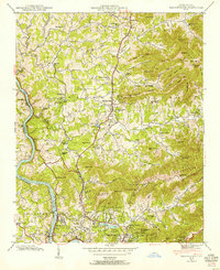
1942 Map of Weaverville
USGS Topo · Published 1954About this map
The French Broad River defines the western edge of this 1942 landscape, where the Southern railroad follows the river's winding course past Alexander. Further east, the town of Weaverville sits as a central hub near Lake Louise, surrounded by a dense network of mountain communities and family-named landmarks. The terrain is characterized by the Flat Creek Mountains and Elk Mountains, where high points like Whitted Knob and Gooch Peak overlook numerous rural institutions.
Find a feature on this map
88 named features on this map. Tap any name to fly to it.
Don’t see what you’re looking for? This feature index may not catch every label — zoom into the map to look around manually.
Map Details
Editions of this 1942 Weaverville Map
This is the sole edition of this map. No revisions or reprints were ever made.
Other maps of this area

1894 · Asheville
USGS Topo · 1:125,000

1900 · Mount Mitchell
USGS Topo · 1:125,000

1901 · Asheville
USGS Topo · 1:125,000

1902 · Mount Mitchell
USGS Topo · 1:125,000

1935 · Barnardsville
USGS Topo · 1:24,000

1935 · Craggy Pinnacle
USGS Topo · 1:24,000

1936 · Marshall
USGS Topo · 1:24,000

1936 · Enka
USGS Topo · 1:24,000

1936 · Weaverville
USGS Topo · 1:24,000

1936 · Mars Hill
USGS Topo · 1:24,000