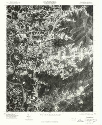
1976 Map of Weaverville
USGS Topo · Published 1979About this map
Weaverville serves as the central hub of this mid-1970s orthophotoquad, which uses rectified aerial imagery to provide a photographic record of the Buncombe County landscape. To the north, the smaller settlement of Stocksville sits near the base of rising terrain, while the northern outskirts of Asheville occupy the southern portion of the sheet. The geography is defined by the sinuous path of the French Broad River on the western edge and several prominent peaks, including Brittain Mountain and Reynolds Mountain. The orthophoto format offers a unique look at land use patterns during this era, showing the clear distinction between cultivated valley bottoms and the dense forest cover of the Elk Mountains. This map is particularly useful for researchers studying 1970s suburban expansion and the exact footprint of forest boundaries and agricultural plots prior to more recent development.
Find a feature on this map
7 named features on this map. Tap any name to fly to it.
Don’t see what you’re looking for? This feature index may not catch every label — zoom into the map to look around manually.
Map Details
Editions of this 1976 Weaverville Map
This is the sole edition of this map. No revisions or reprints were ever made.
Other maps of this area

1894 · Asheville
USGS Topo · 1:125,000

1900 · Mount Mitchell
USGS Topo · 1:125,000

1901 · Asheville
USGS Topo · 1:125,000

1902 · Mount Mitchell
USGS Topo · 1:125,000

1935 · Barnardsville
USGS Topo · 1:24,000

1935 · Craggy Pinnacle
USGS Topo · 1:24,000

1936 · Marshall
USGS Topo · 1:24,000

1936 · Enka
USGS Topo · 1:24,000

1936 · Weaverville
USGS Topo · 1:24,000

1936 · Mars Hill
USGS Topo · 1:24,000