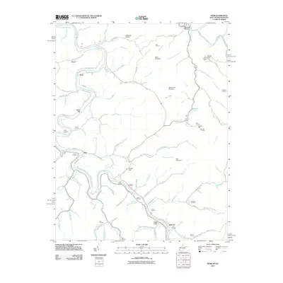
2010 Map of Webb
USGS Topo · Published 2010About this map
The Tug Fork river defines the winding boundary of this landscape, carving through a terrain of named hollows and ridges where small settlements like Webb and Crum serve as local anchors. Family history is etched into the hillsides through numerous burial sites such as Sammons Cemetery, McCoy Cemetery, and Roman Cemetery. The topography is marked by significant elevations like Moses Fork Mountain and Wells Mountain, while the Tick Ridge Lookout Tower stands as a prominent landmark on the eastern high ground near Tick Ridge.
Find a feature on this map
103 named features on this map. Tap any name to fly to it.
Don’t see what you’re looking for? This feature index may not catch every label — zoom into the map to look around manually.
Map Details
Editions of this 2010 Webb Map
This is the sole edition of this map. No revisions or reprints were ever made.
Other maps of this area

1886 · Prestonsburg
USGS Topo · 1:125,000

1887 · Warfield
USGS Topo · 1:125,000

1891 · Warfield
USGS Topo · 1:125,000

1892 · Prestonsburg
USGS Topo · 1:125,000

1892 · Huntington
USGS Topo · 1:125,000

1898 · Huntington
USGS Topo · 1:125,000

1903 · Kenova
USGS Topo · 1:125,000

1904 · Kenova
USGS Topo · 1:125,000

1909 · Wayne
USGS Topo · 1:62,500

1910 · Naugatuck
USGS Topo · 1:48,000