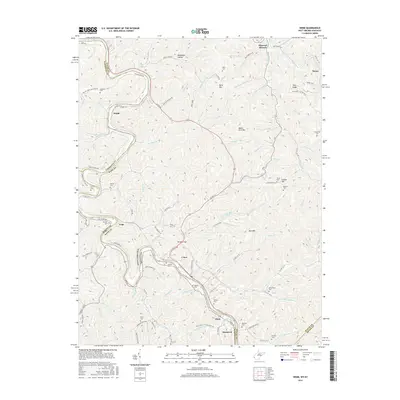
2016 Map of Webb
USGS Topo · Published 2016About this map
Tug Fork carves a deep valley along the boundary between West Virginia and Kentucky, serving as the primary corridor for both the Norfolk Southern railway and US Rte 52. The landscape is defined by its numerous small settlements and family cemeteries that line the steep hollows, particularly around Crum and Webb. This 2016 survey documents the enduring community structures of Wayne County, including Missouri Branch and Hode, where residential development clings to the narrow flatlands beside Bull Mtn and Wells Mtn. The proliferation of burial sites such as Sammons Cem, McCoy Cem, and Parsley Cem provides a dense genealogical record for families connected to these Appalachian hills. The road network, including Hode Rd and Webb Rd, follows the winding paths of creeks like Jennie Cr and Bark Camp Br, illustrating how the local geography has dictated transit for generations.
Find a feature on this map
128 named features on this map. Tap any name to fly to it.
Don’t see what you’re looking for? This feature index may not catch every label — zoom into the map to look around manually.
Map Details
Editions of this 2016 Webb Map
This is the sole edition of this map. No revisions or reprints were ever made.
Other maps of this area

1886 · Prestonsburg
USGS Topo · 1:125,000

1887 · Warfield
USGS Topo · 1:125,000

1891 · Warfield
USGS Topo · 1:125,000

1892 · Prestonsburg
USGS Topo · 1:125,000

1892 · Huntington
USGS Topo · 1:125,000

1898 · Huntington
USGS Topo · 1:125,000

1903 · Kenova
USGS Topo · 1:125,000

1904 · Kenova
USGS Topo · 1:125,000

1909 · Wayne
USGS Topo · 1:62,500

1910 · Naugatuck
USGS Topo · 1:48,000