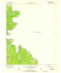
1954 Map of Webb
USGS Topo · Published 1955About this map
Tug Fork carves a winding path along the boundary between Kentucky and West Virginia, defining the landscape of this 1954 survey. Numerous gas and oil wells dot the narrow valleys and ridges, reflecting the region's mid-century energy production. Small rural communities like Hode and Jarrell are anchored by a high density of local schools and churches, such as Temple Bell Ch and Chaffin Sch. The settlement pattern follows the drainage of various creeks, including Spruce Fork and Elk Creek, where families established homesteads and burial grounds like Salmons Cem. This map provides a detailed view of the social infrastructure of the central Appalachian hollows, where educational sites like Forks of Elk Creek Sch and Baker Gap Sch served as local landmarks.
Find a feature on this map
49 named features on this map. Tap any name to fly to it.
Don’t see what you’re looking for? This feature index may not catch every label — zoom into the map to look around manually.
Map Details
Editions of this 1954 Webb Map
This is the sole edition of this map. No revisions or reprints were ever made.
Other maps of this area

1886 · Prestonsburg
USGS Topo · 1:125,000

1887 · Warfield
USGS Topo · 1:125,000

1891 · Warfield
USGS Topo · 1:125,000

1892 · Prestonsburg
USGS Topo · 1:125,000

1892 · Huntington
USGS Topo · 1:125,000

1898 · Huntington
USGS Topo · 1:125,000

1903 · Kenova
USGS Topo · 1:125,000

1904 · Kenova
USGS Topo · 1:125,000

1909 · Wayne
USGS Topo · 1:62,500

1910 · Naugatuck
USGS Topo · 1:48,000