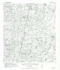
1956 Map of Webb
USGS Topo · Published 1956About this map
Webb serves as a primary waypoint along the International Great Northern Railroad in this south Texas landscape. The map reveals a region defined by extensive landholdings and ranching operations, such as the Callaghan Ranch and the Jabalina Ranch. Transportation and commerce are tied to the corridor of U S Highway No 81, which parallels the rail line through the heart of the territory.
Find a feature on this map
39 named features on this map. Tap any name to fly to it.
Don’t see what you’re looking for? This feature index may not catch every label — zoom into the map to look around manually.
Map Details
Editions of this 1956 Webb Map
This is the sole edition of this map. No revisions or reprints were ever made.
Other maps of this area
1929 · Cotulla
USGS Topo · 1:125,000
1937 · Aguilete Creek
USGS Topo · 1:62,500
1940 · Velenzuela Creek
USGS Topo · 1:62,500
1953 · Crystal City
USGS Topo · 1:250,000
1955 · Crystal City
USGS Topo · 1:250,000
1956 · Las Tiendas
USGS Topo · 1:62,500
1956 · Becerra
USGS Topo · 1:62,500
1956 · Islitas
USGS Topo · 1:62,500
1956 · Laredo East
USGS Topo · 1:62,500
1956 · Laredo
USGS Topo · 1:250,000