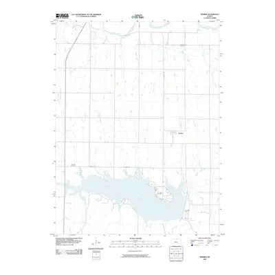
2009 Map of Webber
USGS Topo · Published 2009About this map
Lovewell Reservoir dominates the southern landscape of this Jewell County region, formed by the Lovewell Dam along White Rock Creek. This water management system is a defining feature of the area, providing a stark contrast to the agricultural grid that surrounds the small settlement of Webber. The northern edge of the map is traced by the winding path of the Republican River, while smaller tributaries like Montana Creek and Bean Creek drain the surrounding fields. For those researching family history, several burial grounds are preserved across the quadrangle, including Valley View Cemetery near the northern border, Montana Cemetery to the west, and Dahl Cemetery positioned near the reservoir's northeastern shore. The map also documents the local road network, specifically Webber Rd and N Shore Rd, which facilitate travel between the rural farmsteads and the water's edge.
Find a feature on this map
13 named features on this map. Tap any name to fly to it.
Don’t see what you’re looking for? This feature index may not catch every label — zoom into the map to look around manually.
Map Details
Editions of this 2009 Webber Map
This is the sole edition of this map. No revisions or reprints were ever made.
Other maps of this area

1892 · Concordia
USGS Topo · 1:125,000

1894 · Mankato
USGS Topo · 1:125,000

1898 · Superior
USGS Topo · 1:125,000

1898 · Hebron
USGS Topo · 1:125,000

1955 · Manhattan
USGS Topo · 1:250,000

1955 · Lincoln
USGS Topo · 1:250,000

1955 · Grand Island
USGS Topo · 1:250,000

1955 · Beloit
USGS Topo · 1:250,000

1956 · Manhattan
USGS Topo · 1:250,000

1957 · Manhattan
USGS Topo · 1:250,000