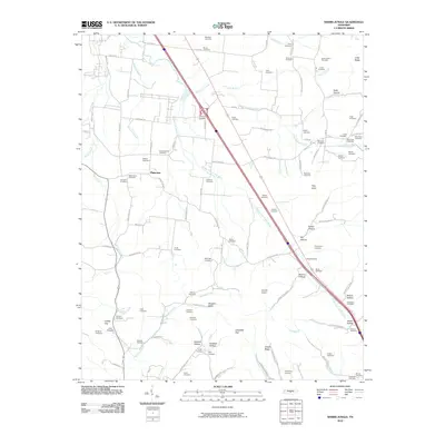
2010 Map of Webbs Jungle
USGS Topo · Published 2010About this map
Middle Fork Stones River carves a central path through this Tennessee landscape, shaping the development of settlements like Plainview and Woodfin Valley. The region is defined by its series of narrow gaps and hollows, including the strategically positioned Hoovers Gap and the nearby Dismal Hollow. The settlement pattern here is deeply personal, with dozens of family-named cemeteries such as Robinson Cemetery, Mayfield Cemetery, and Newman Cemetery scattered across the drainages of Big Springs Creek and Hurricane Creek. These burial grounds serve as a map of the area's ancestral homesteads and early communities. Further south, the terrain rises toward Jungle Ridge and Pilot Knob, while the road network follows the natural contours of Wartrace Creek and Jake Branch, connecting rural life to the ridges and valleys of the Stones River watershed.
Find a feature on this map
109 named features on this map. Tap any name to fly to it.
Don’t see what you’re looking for? This feature index may not catch every label — zoom into the map to look around manually.
Map Details
Editions of this 2010 Webbs Jungle Map
This is the sole edition of this map. No revisions or reprints were ever made.
Other maps of this area

1908 · Woodbury
USGS Topo · 1:62,500

1913 · Hollow Springs
USGS Topo · 1:62,500

1916 · Murfreesboro
USGS Topo · 1:62,500

1936 · Webbs Jungle
USGS Topo · 1:24,000

1936 · Deason
USGS Topo · 1:24,000

1936 · Beech Grove
USGS Topo · 1:24,000

1936 · Noah
USGS Topo · 1:24,000

1936 · Wartrace
USGS Topo · 1:24,000

1936 · Fosterville
USGS Topo · 1:24,000

1942 · Statesville
USGS Topo · 1:100,000