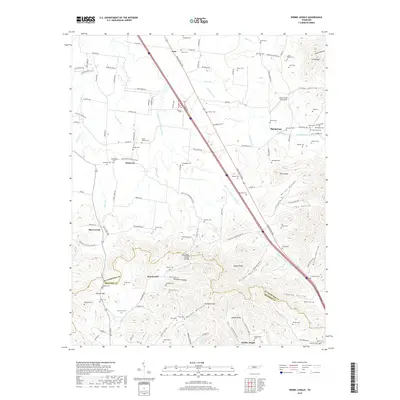
2019 Map of Webbs Jungle
USGS Topo · Published 2019About this map
The Tennessee Valley Divide carves a path through this landscape, separating the headwaters of Wartrace Cr from the northern drainage of the Middle Fork Stones River. Centered near the border of Rutherford and Bedford counties, this region is defined by a dense network of family-named cemeteries and small rural settlements like Beechwood, Plainview, and Webbs Jungle. The terrain is deeply corrugated by hollows such as Hatchett Hollow and Eaton Hollow, while the Cedar Glade Aerodrome stands out as a modern landmark north of the Pilot Knob summit.
Find a feature on this map
133 named features on this map. Tap any name to fly to it.
Don’t see what you’re looking for? This feature index may not catch every label — zoom into the map to look around manually.
Map Details
Editions of this 2019 Webbs Jungle Map
This is the sole edition of this map. No revisions or reprints were ever made.
Other maps of this area

1908 · Woodbury
USGS Topo · 1:62,500

1913 · Hollow Springs
USGS Topo · 1:62,500

1916 · Murfreesboro
USGS Topo · 1:62,500

1936 · Webbs Jungle
USGS Topo · 1:24,000

1936 · Deason
USGS Topo · 1:24,000

1936 · Beech Grove
USGS Topo · 1:24,000

1936 · Noah
USGS Topo · 1:24,000

1936 · Wartrace
USGS Topo · 1:24,000

1936 · Fosterville
USGS Topo · 1:24,000

1942 · Statesville
USGS Topo · 1:100,000