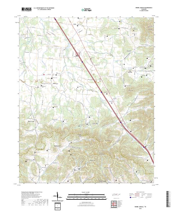
2022 Map of Webbs Jungle
USGS Topo · Published 2022About this map
The Middle Fork Stones River carves a path through this central Tennessee landscape, following the corridor of the Manchester Pike. This modern survey reveals a dense concentration of small family and community burial grounds, such as the Old Millersburg Cem and the Joel Broyles Family Cem, which anchor the histories of local settlements like Plainview and Short Creek. The southern portion of the map is defined by a complex network of ridges and hollows, including Dismal Hollow and Hatchett Hollow, where the terrain crosses the Rutherford Co and Bedford Co line.
Find a feature on this map
130 named features on this map. Tap any name to fly to it.
Don’t see what you’re looking for? This feature index may not catch every label — zoom into the map to look around manually.
Map Details
Editions of this 2022 Webbs Jungle Map
This is the sole edition of this map. No revisions or reprints were ever made.
Other maps of this area

1908 · Woodbury
USGS Topo · 1:62,500

1913 · Hollow Springs
USGS Topo · 1:62,500

1916 · Murfreesboro
USGS Topo · 1:62,500

1936 · Webbs Jungle
USGS Topo · 1:24,000

1936 · Deason
USGS Topo · 1:24,000

1936 · Beech Grove
USGS Topo · 1:24,000

1936 · Noah
USGS Topo · 1:24,000

1936 · Wartrace
USGS Topo · 1:24,000

1936 · Fosterville
USGS Topo · 1:24,000

1942 · Statesville
USGS Topo · 1:100,000