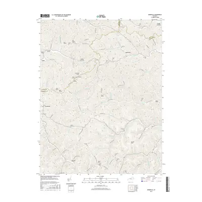
2016 Map of Webbville
USGS Topo · Published 2016About this map
Webbville and the surrounding tri-county borderlands of Carter, Lawrence, and Boyd counties define this landscape of deeply carved hollows and prominent ridges. The map reveals a settlement pattern tied to the winding watercourses, with communities like Glenwood and Jeriel situated near the headwaters of the Little Sandy River. For genealogists, the map is remarkably dense with family-named landmarks and resting places, ranging from the James C Webb Cem and Webbville Cem to the Crabtree Cem and Howell Cem. High points such as Hinton Knob, Bishop Knob, and Red Mud Ridge provide a topographical frame for the complex network of local branches and forks, including Bells Trace Cr and Little Cat Fork. Evidence of the region's industrial and agricultural history is seen in names like Sandy Furnace and Sawmill Hollow, while unique local nomenclature like Dead Man Hollow adds distinctive character to the geographic record.
Find a feature on this map
114 named features on this map. Tap any name to fly to it.
Don’t see what you’re looking for? This feature index may not catch every label — zoom into the map to look around manually.
Map Details
Editions of this 2016 Webbville Map
This is the sole edition of this map. No revisions or reprints were ever made.
Other maps of this area

1901 · Ceredo
USGS Topo · 1:62,500

1903 · Kenova
USGS Topo · 1:125,000

1904 · Kenova
USGS Topo · 1:125,000

1911 · Louisa
USGS Topo · 1:48,000

1913 · Ceredo
USGS Topo · 1:62,500

1913 · Louisa
USGS Topo · 1:62,500

1939 · Louisa
USGS Topo · 1:62,500

1953 · Grayson
USGS Topo · 1:24,000

1953 · Rush
USGS Topo · 1:24,000

1953 · Boltsfork
USGS Topo · 1:24,000