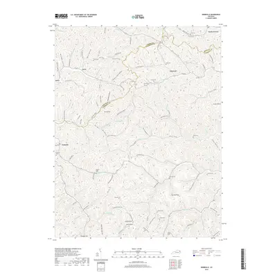
2019 Map of Webbville
USGS Topo · Published 2019About this map
The E Fork Little Sandy River flows through this corner of the Cumberland Plateau where the borders of Carter, Lawrence, and Boyd counties meet. The landscape is defined by a dense network of hollows and ridges, such as Sawmill Hollow and Red Mud Ridge, which dictated the early settlement patterns of the region. Small communities like Webbville and Glenwood serve as hubs for the surrounding family-named landmarks. The map documents numerous burial grounds essential for genealogical research, including the Webbville Cem, Coburn Cem, and Taylor Cem. Infrastructure from the area's industrial past and present is evident in the proximity of Sandy Furnace and the presence of Strip Mine Rd, highlighting the intersection of traditional Appalachian agriculture and natural resource extraction in eastern Kentucky.
Find a feature on this map
107 named features on this map. Tap any name to fly to it.
Don’t see what you’re looking for? This feature index may not catch every label — zoom into the map to look around manually.
Map Details
Editions of this 2019 Webbville Map
This is the sole edition of this map. No revisions or reprints were ever made.
Other maps of this area

1901 · Ceredo
USGS Topo · 1:62,500

1903 · Kenova
USGS Topo · 1:125,000

1904 · Kenova
USGS Topo · 1:125,000

1911 · Louisa
USGS Topo · 1:48,000

1913 · Ceredo
USGS Topo · 1:62,500

1913 · Louisa
USGS Topo · 1:62,500

1939 · Louisa
USGS Topo · 1:62,500

1953 · Grayson
USGS Topo · 1:24,000

1953 · Rush
USGS Topo · 1:24,000

1953 · Boltsfork
USGS Topo · 1:24,000