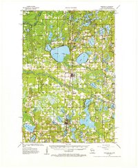
1955 Map of Webster
USGS Topo · Published 1979About this map
Yellow Lake and the winding Yellow River dominate the central landscape of this Burnett County region during the mid-1950s. The village of Webster serves as a primary hub, while the Soo Line railroad connects the area to the broader Minneapolis Sault Ste Marie and Atlantic network. The survey reveals a high density of rural infrastructure typical of the era, including numerous town halls and local schools like Karlsborg Sch and Orange Sch.
Find a feature on this map
105 named features on this map. Tap any name to fly to it.
Don’t see what you’re looking for? This feature index may not catch every label — zoom into the map to look around manually.
Map Details
Editions of this 1955 Webster Map
3 editions found

Other maps of this area

1949 · Danbury
USGS Topo · 1:48,000

1949 · Hertel
USGS Topo · 1:48,000

1949 · Webb Lake
USGS Topo · 1:48,000

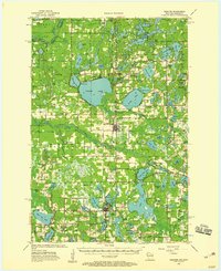
1950 · Webster
USGS Topo · 1:48,000

1950 · Grantsburg
USGS Topo · 1:48,000

1951 · Cumberland
USGS Topo · 1:48,000

1951 · Milltown
USGS Topo · 1:48,000

1951 · Frederic
USGS Topo · 1:48,000

1953 · Duluth
USGS Topo · 1:250,000

1953 · Stillwater
USGS Topo · 1:250,000