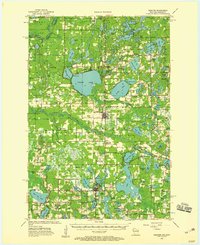
1955 Map of Webster
USGS Topo · Published 1959About this map
Yellow Lake and the winding Yellow River dominate this mid-century survey of northwestern Wisconsin's lake country. The landscape is defined by its glacial heritage, featuring a dense network of water bodies including Lower Clam Lake, Mud Hen Lake, and Devils Lake. These waters served as the primary geography for early settlement, with the villages of Webster and Siren anchored along the Minneapolis St Paul and Sault Ste Marie railroad line, also labeled here as the Soo Line.
Find a feature on this map
99 named features on this map. Tap any name to fly to it.
Don’t see what you’re looking for? This feature index may not catch every label — zoom into the map to look around manually.
Map Details
Editions of this 1955 Webster Map
3 editions found

Other maps of this area

1949 · Danbury
USGS Topo · 1:48,000

1949 · Hertel
USGS Topo · 1:48,000

1949 · Webb Lake
USGS Topo · 1:48,000

1950 · Webster
USGS Topo · 1:48,000

1950 · Grantsburg
USGS Topo · 1:48,000

1951 · Cumberland
USGS Topo · 1:48,000

1951 · Milltown
USGS Topo · 1:48,000

1951 · Frederic
USGS Topo · 1:48,000

1953 · Duluth
USGS Topo · 1:250,000

1953 · Stillwater
USGS Topo · 1:250,000