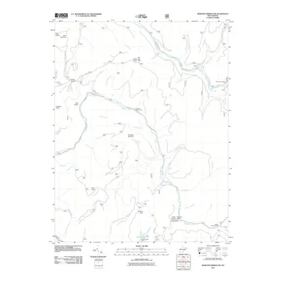
2011 Map of Webster Springs SW
USGS Topo · Published 2011About this map
Mills Mountain and Red Oak Knob dominate this high-elevation landscape in the West Virginia highlands during the early 21st century. The terrain is defined by the deep drainage basins of the Cranberry River and the Williams River, which carve through the peaks of Bishop Knob and Snakeden Mountain. Human presence is primarily represented through recreational and forestry infrastructure, including the Red Oak Lookout Tower and remote locations such as the Pleasant Hollow Camping Shelter and Dogway Camping Shelter. A single historical site, Blacks Chapel Cemetery, sits in the northwest near the headwaters of Craig Run. The map illustrates a complex network of forest roads like Pub Rd 76 and Pub Rd 101, facilitating access to Cranberry Campground and the Summit Lake Dam in the south.
Find a feature on this map
58 named features on this map. Tap any name to fly to it.
Don’t see what you’re looking for? This feature index may not catch every label — zoom into the map to look around manually.
Map Details
Editions of this 2011 Webster Springs SW Map
This is the sole edition of this map. No revisions or reprints were ever made.
Other maps of this area

1889 · Nicholas
USGS Topo · 1:125,000

1891 · Nicholas
USGS Topo · 1:125,000

1891 · Huntersville
USGS Topo · 1:125,000

1894 · Huntersville
USGS Topo · 1:125,000

1901 · Nicholas
USGS Topo · 1:125,000

1915 · Webster Springs
USGS Topo · 1:48,000

1915 · Cowen
USGS Topo · 1:48,000

1917 · Cowen
USGS Topo · 1:62,500

1918 · Webster Springs
USGS Topo · 1:62,500

1918 · Richwood
USGS Topo · 1:62,500