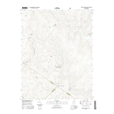
2014 Map of Webster Springs SW
USGS Topo · Published 2014About this map
Monongahela National Forest land defines this portion of West Virginia, where high ridges and deep drainages meet at the intersection of Webster, Nicholas, and Greenbrier counties. The topography is dominated by significant summits such as Red Oak Knob, Bishop Knob, and Briery Knob, which provide a steep backdrop for the waterway network. The Red Oak Lookout Tower stands as a prominent man-made landmark atop its namesake peak, overlooking a landscape where the Williams River and Cranberry River flow through narrow valleys.
Find a feature on this map
50 named features on this map. Tap any name to fly to it.
Don’t see what you’re looking for? This feature index may not catch every label — zoom into the map to look around manually.
Map Details
Editions of this 2014 Webster Springs SW Map
This is the sole edition of this map. No revisions or reprints were ever made.
Other maps of this area

1889 · Nicholas
USGS Topo · 1:125,000

1891 · Nicholas
USGS Topo · 1:125,000

1891 · Huntersville
USGS Topo · 1:125,000

1894 · Huntersville
USGS Topo · 1:125,000

1901 · Nicholas
USGS Topo · 1:125,000

1915 · Webster Springs
USGS Topo · 1:48,000

1915 · Cowen
USGS Topo · 1:48,000

1917 · Cowen
USGS Topo · 1:62,500

1918 · Webster Springs
USGS Topo · 1:62,500

1918 · Richwood
USGS Topo · 1:62,500