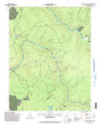
1995 Map of Webster Springs SW
USGS Topo · Published 1998About this map
Mills Mtn and the nearby Mills Mtn Ch stand at the northwestern edge of this 1995 survey, reflecting the sparse highland settlement of this part of West Virginia. The landscape is dominated by the Monongahela National Forest and the protected Cranberry Wilderness, where complex drainage systems like White Oak Fork and Lick Branch feed into the Williams River. Notable landmarks such as Red Oak Knob feature a Lookout, while Summit Lake serves as a significant water body in the southern reaches.
Find a feature on this map
59 named features on this map. Tap any name to fly to it.
Don’t see what you’re looking for? This feature index may not catch every label — zoom into the map to look around manually.
Map Details
Editions of this 1995 Webster Springs SW Map
This is the sole edition of this map. No revisions or reprints were ever made.
Other maps of this area

1889 · Nicholas
USGS Topo · 1:125,000

1891 · Nicholas
USGS Topo · 1:125,000

1891 · Huntersville
USGS Topo · 1:125,000

1894 · Huntersville
USGS Topo · 1:125,000

1901 · Nicholas
USGS Topo · 1:125,000

1915 · Webster Springs
USGS Topo · 1:48,000

1915 · Cowen
USGS Topo · 1:48,000

1917 · Cowen
USGS Topo · 1:62,500

1918 · Webster Springs
USGS Topo · 1:62,500

1918 · Richwood
USGS Topo · 1:62,500