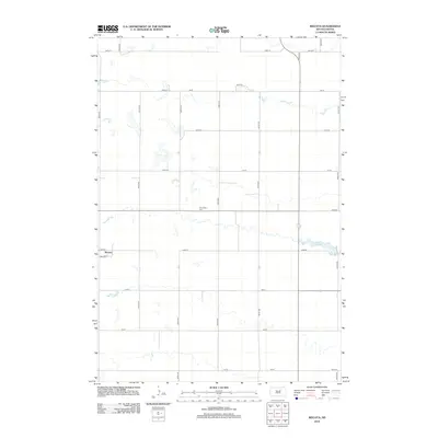
2012 Map of Wecota
USGS Topo · Published 2012About this map
Wecota sits in the northwest corner of this agricultural survey, defined by a rigid grid of section-line roads such as 354th Ave and 153rd St. This portion of Faulk County is characterized by numerous small water bodies and seasonal basins scattered across the prairie, with Lake Cresbard being the most prominent named feature in the east. The placement of Immanuel Cem near the intersection of 152nd St and 356th Ave provides a specific point of interest for genealogists and local historians tracking family roots in this rural township. The map illustrates a landscape of high-plains farming, where small-scale drainage patterns and gravel roads connect isolated homesteads to the small settlement at Wecota.
Find a feature on this map
23 named features on this map. Tap any name to fly to it.
Don’t see what you’re looking for? This feature index may not catch every label — zoom into the map to look around manually.
Map Details
Editions of this 2012 Wecota Map
This is the sole edition of this map. No revisions or reprints were ever made.
Other maps of this area

1899 · Northville
USGS Topo · 1:125,000

1952 · Norbeck
USGS Topo · 1:24,000

1952 · Wecota
USGS Topo · 1:24,000

1952 · Faulkton West
USGS Topo · 1:24,000

1952 · Faulkton East
USGS Topo · 1:24,000

1954 · Aberdeen
USGS Topo · 1:250,000

1956 · Aberdeen
USGS Topo · 1:250,000
1966 · Cresbard SW
USGS Topo · 1:24,000

1966 · Cresbard
USGS Topo · 1:24,000

1970 · Mina SW
USGS Topo · 1:24,000