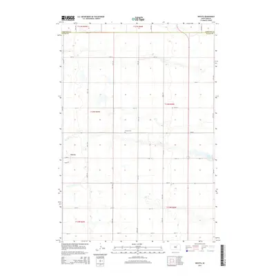
2015 Map of Wecota
USGS Topo · Published 2015About this map
Wecota anchors this rural landscape at the edge of the Edmunds Co and Faulk Co line, representing a classic Northern Plains grid-iron settlement pattern. The terrain is defined by low-lying wetlands and seasonal water bodies, most notably Lake Cresbard in the eastern reaches. This 2015 study by the U.S. Geological Survey captures the enduring agricultural structure of the region, where a dense network of numbered section roads like 152nd St and 354th Ave provides access to vast tracts of farmland. The Immanuel Cem serves as a quiet landmark for local genealogists, situated centrally amidst the township divisions of T120N R68W and T120N R69W. The map reflects a landscape where water and road networks dictate the placement of early prairie outposts.
Find a feature on this map
26 named features on this map. Tap any name to fly to it.
Don’t see what you’re looking for? This feature index may not catch every label — zoom into the map to look around manually.
Map Details
Editions of this 2015 Wecota Map
This is the sole edition of this map. No revisions or reprints were ever made.
Other maps of this area

1899 · Northville
USGS Topo · 1:125,000

1952 · Norbeck
USGS Topo · 1:24,000

1952 · Wecota
USGS Topo · 1:24,000

1952 · Faulkton West
USGS Topo · 1:24,000

1952 · Faulkton East
USGS Topo · 1:24,000

1954 · Aberdeen
USGS Topo · 1:250,000

1956 · Aberdeen
USGS Topo · 1:250,000
1966 · Cresbard SW
USGS Topo · 1:24,000

1966 · Cresbard
USGS Topo · 1:24,000

1970 · Mina SW
USGS Topo · 1:24,000