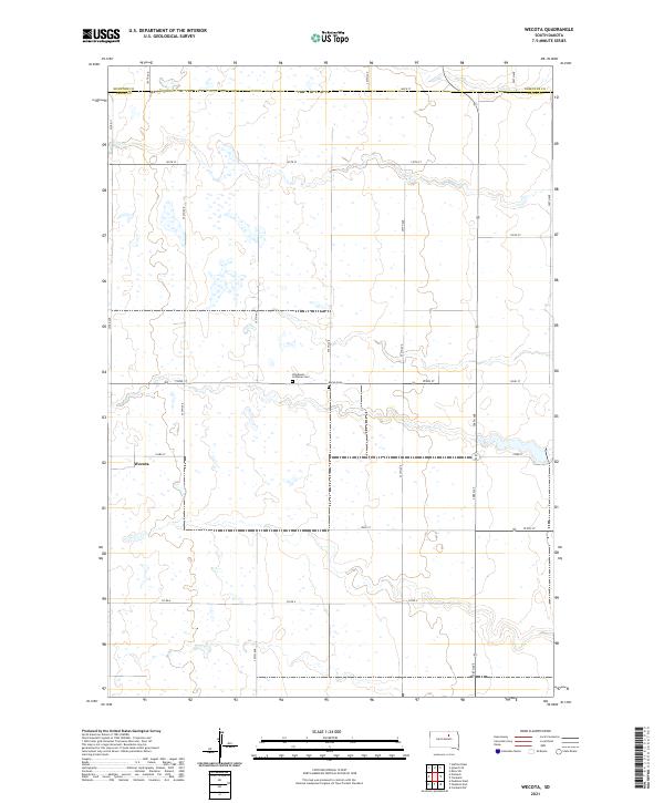
2021 Map of Wecota
USGS Topo · Published 2021About this map
Wecota anchors this rural landscape at the edge of the Faulk Co and Edmunds Co line. The map reveals a highly structured prairie environment defined by the Public Land Survey System, where a grid of section-line roads like 355th Ave and 152nd St provides the primary framework for local travel. Scattered throughout this agricultural expanse are small, localized landmarks that point to the area's social history, specifically the Immanuel Lutheran Cem and Myron Cem, both situated near the center of the quadrangle. These sites, along with the cluster of buildings at the Wecota settlement, represent the sparse but deliberate footprint of human activity in this corner of South Dakota, where the topography is shaped by subtle drainage patterns and seasonal wetlands characteristic of the northern plains.
Find a feature on this map
25 named features on this map. Tap any name to fly to it.
Don’t see what you’re looking for? This feature index may not catch every label — zoom into the map to look around manually.
Map Details
Editions of this 2021 Wecota Map
This is the sole edition of this map. No revisions or reprints were ever made.
Other maps of this area

1899 · Northville
USGS Topo · 1:125,000

1952 · Norbeck
USGS Topo · 1:24,000

1952 · Wecota
USGS Topo · 1:24,000

1952 · Faulkton West
USGS Topo · 1:24,000

1952 · Faulkton East
USGS Topo · 1:24,000

1954 · Aberdeen
USGS Topo · 1:250,000

1956 · Aberdeen
USGS Topo · 1:250,000
1966 · Cresbard SW
USGS Topo · 1:24,000

1966 · Cresbard
USGS Topo · 1:24,000

1970 · Mina SW
USGS Topo · 1:24,000